
One of the many challenges facing collaborative projects is the successful coordination of data and of course making sure that the coordinates and levels are correct in all models and drawings. To make this task a little simpler you can now use a very simple tool that effectively matches the coordinates from AutoCAD Civil 3D 2014 to Revit 2014. This is achieved through shared coordinates.

This tool is available as part of a subscription and is a component of the Civil 3D productivity tools. It is worth considering this workflow if your company uses both AutoCAD Civil 3D and Revit or if you are working with external surveyors that use AutoCAD Civil 3D.
The first step is to launch the Export Shared Reference points from the Toolbox Tab within Civil 3D (please note that you will need to first install this from the Autodesk subscription centre).

Once you have done this then you will be prompted for the ORIGIN point and then a point in the positive Y Axis (Quasi-North). This point should be a point along the intended project north. Another point to note is that the Z coordinate (the Level) will also be transferred to Revit so make sure this is correctly set. Of course you may need to ask the Revit team what they are using for project north.

You should then see the Select Units and Confirm dialog box. Here you can specify the DWG units and check the Easting and Northing data.

You then save an XML file which holds the above information. This can be emailed to the Revit team or uploaded to a shared location.
That’s the AutoCAD Civil3D process completed. Of course, if the site location changes then you would just repeat the process but give the XML file a revised name.
The Process in Revit 2014
The Revit technician can start the model before the survey is undertaken and the BIM coordinator will update the location, rotation and levels once the tool has been executed in Revit 2014.
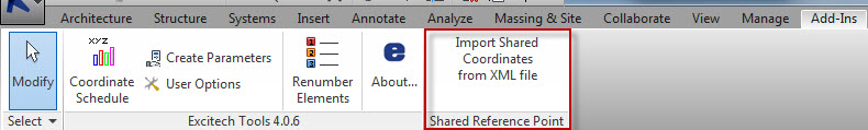
The first step is to select the Import Shared Coordinates tool from the Add Ins tab (again you will need to make sure that you have this installed from the Autodesk Subscription Centre).
You will then be prompted for the Origin point. It is recommended that you draw a Reference Plane from the Origin point and to an arbitrary point along the project north to aid snapping.

You then specify the XML file and Revit 2014 will report that the Coordinates were successfully shared.

The next step is to set this shared coordinate as the current system. On the Manage Ribbon select the Location command. On the Site tab select the Shared Coordinate and then the Make Current button. The Coordination should now be set.


You can check this by setting the Site Plan to True North, placing a coordinate at the setting out point and also making sure that the Levels are set to read the Survey Point.
Hope this has been useful,
LawrenceH

Hi I have not been able to locate the ‘import shared coordinates from XML file’ that you mention. If you could leave a link that would be helpful. I am trying to import an XML file into RevIt in order to calculate the volume of a containment wall, any help appreciated thanks!
Hi, you will just need to log on to your subscription centre and download the Revit extensions. This will allow you to import a C3D file.
Wow! This is a great feature! Getting coordinates to match with Civil seems to always be a challenge